Overview

The San Luis Rey Watershed encompasses a land area of about 560 square miles. It lies in the northern portion of the County and neighbors Santa Margarita Watershed to the north and Carlsbad and San Dieguito Watersheds to the south.
The watershed can be delineated into three distinct hydrological areas, each with unique geological and environmental features:
- Lower San Luis Rey (903.1)
- Monserate (903.2)
- Warner Valley (903.3)
Rainfall to the area primarily drains through the San Luis Rey River, which stretches east to west over a length of about fifty-five (55) miles and originates in the Palomar and Hot Springs Mountains. The river eventually discharges to the Pacific Ocean near the City of Oceanside.
San Luis Rey Watershed supplies area residents with potable water sourced from Turner Reservoir and Lake Henshaw, as well as a number of underground aquifers. Lake Henshaw drains approximately 209 square miles of land located in the Warner Valley Hydrologic Area, in the eastern third of the watershed. The WMA also is home to six groundwater aquifers: Warner, Pauma, Pala, Bonsall, Moosa, and Mission Basins.
Currently, about fifty-four percent (54%) of the watershed management area (WMA) remains undeveloped. The remaining forty-six percent (46%) of the land area is being utilized for residential areas (15%), agricultural uses (14%), and other uses. Roughly fourteen percent (14%) of the watershed is also comprised of six (6) federally recognized Tribal Indian Reservations. For more detailed breakdowns by hydrologic area, please see the Lower San Luis Rey, Monserate, and Warner Valley Hydrologic Area descriptions below.
The San Luis Rey Watershed is estimated to be home to approximately 166,000 residents, according to 2010 US Census data. The population is most highly concentrated downstream in and around the Cities of Oceanside and Vista. Particularly near these more urbanized areas, water bodies suffer from several pollutants, which have the potential to negatively impact how residents, business-owners, and tourists use and interact with them.
It is important to note that the watershed serves more than just humans. The San Luis Rey Watershed consists of a variety of unique and diverse ecosystems that act as critical habitat for several species of concern, including the orange-throated whiptail, western skink, and the California pocket mouse.
For more information about water bodies see the San Diego Basin Plan, which provides information on uses of water bodies and water quality objectives, beneficial uses and the 303(d) list, which identifies water body segments not meeting water quality standards.
Water Quality Improvement Plan (WQIP)
Agencies involved in the development of the San Luis Rey Water Quality Improvement Plan (WQIP) include the Cities of Oceanside and Vista, the County of San Diego, and the California Department of Transportation. The WQIP is a requirement of updated stormwater regulations adopted by the Regional Water Quality Control Board (Regional Board) according to Order No. R9-2013-0001, as amended by Order Nos. R9 2015-0001 and R9-2015-0100. The ultimate goal of the WQIP is to protect, preserve, enhance, and restore water quality of receiving water bodies. These improvements in water quality will be accomplished through an adaptive planning and management process that identifies the highest priority water quality conditions within the watershed and implements strategies to address them.
The San Luis Rey Water Quality Improvement Plan was originally submitted to the Regional Board on June 26, 2015, as required by the Municipal Permit. The WQIP was subsequently revised and resubmitted in order to incorporate comments received from the public and the Regional Board. Following further comments, the Regional Board issued an acceptance letter for the San Luis Rey WQIP on February 12, 2016.
Water Quality Improvement Plan Update 2022
The San Luis Rey Watershed Management Area jurisdictions developed an update of the Water Quality Improvement Plan (WQIP). The WQIP update focuses on revisions to the process to evaluate the WMA’s WQIP Priority Water Quality Conditions, results from the revised prioritization process, and an update to the Reasonable Assurance Demonstration to support the attainment of wet weather goals for the watershed related to bacteria. The update was submitted to the San Diego Regional Water Quality Control Board with the WQIP 2020-2021 Annual Report. The WQIP update was subsequently revised and resubmitted on September 20, 2022 and with the WQIP 2021-2022 Annual Report to incorporate comments from the Regional Board regarding the Reasonable Assurance Demonstration. The Regional Board issued an acceptance letter for the revised San Luis Rey WQIP update on January 11, 2023.
https://projectcleanwater.org/download/san-luis-rey-wqip-2021-2022-annual-report-and-update/
Water Quality Improvement Plan Update - Public Call for Data
The Agencies in the San Luis Rey River Watershed are considering an update to the Water Quality Improvement Plan (WQIP). This update would be in accordance with the optional compliance pathway described in Provision B.3.c of the San Diego Region’s Municipal Separate Storm Sewer Systems Permit. Provision B.3.c requires a more comprehensive planning and implementation process, but also provides numerous benefits including flexibility to define a San Luis Rey-specific approach, opportunities to pursue projects with multiple benefits to water quality and strengthen relationships with stakeholders.
The process to update the WQIP is anticipated to be accomplished in three phases. The Agencies have completed Phase I of the process and are initiating Phase II with this call for data.
- Phase I focused on the selection of pollutants, conditions, and waterbodies to be included in further analysis, and development of a conceptual approach for compliance with Provision B.3.c.
- Phase II consists of the quantitative analyses and technical work to support compliance with Provision B.3.c including the development of control measures, water quality goals, schedules for achieving the goals, and specific monitoring and assessments plans.
- Phase III addresses the formal WQIP update process as required in Provision F of the Permit.
To support Phase II, the Agencies are requesting available, relevant, and appropriately collected and analyzed water quality and hydrology data in electronic format (Excel format is preferred). All submitted data will be reviewed. It is beneficial if the data has been collected under a quality assurance project plan or method (e.g., Surface Water Ambient Monitoring Program) and analyzed by an Environmental Laboratory Accreditation Program certified laboratory. To ensure the data can be integrated into the assessment, please include the following information:
- Location of sampling events or data collection (latitude/longitude coordinates);
- Dates and times of sample collection;
- Sampling event conditions (dry weather or storm event);
- Data for Quality Assurance/Quality Control samples; and
- Quality Assurance Project Plan(s), if applicable.
Technical or summary reports for large data sets are also appreciated. If submitting such reports, please include pertinent contact information (name, email, phone number) along with the data submittal.
For data to be considered for inclusion in this effort, data must be provided no later than 5:00 pm on August 12, 2023. The data and relevant reports can be submitted to [email protected].
Please refer to the 2021-22 WQIP Annual Report for more information on the WQIP and implementation efforts.
WQIP Annual Reports
The San Luis Rey Watershed Management Area (WMA) Water Quality Improvement Plan (WQIP) Annual Reports allow copermittees to demonstrate progress made during the fiscal year towards achieving water quality goals. They are a direct requirement of the National Pollutant Discharge Elimination System (NPDES) Permit, Order No. R9-2013-0001, as amended by Order Nos. R9-2015-0001 and R9-2015-0100. The Annual Reports contain specific information regarding strategy implementation and monitoring efforts and data. Furthermore, they serve as a basis upon which copermittees may choose to adaptively manage their highest priorities and goals/strategies, according to the most recent water quality data.
For most San Diego Region watersheds, FY 2015-16 is the first year of WQIP implementation and is therefore the first year of annual reporting. Annual reports are submitted to the Regional Board by January 31 of the following year.
Below are the most recent annual reports, to view years prior to 2015-2016 click here.
Jurisdictional Runoff Management Plans
The Regional Stormwater Permit (Order No. R9-2013-0001, as amended by Order Nos. R9-2015-0001 and R9-2015-0100) requires that the San Diego Region Copermittees provide access to their Jurisdictional Runoff Management Program documents on a Regional Clearinghouse website. The purpose of JRMP documents are to guide implementation of programs and strategies to reduce pollutants discharged from each Copermittee’s storm drain system to receiving waters. The JRMPs for each Copermittee involved in the San Luis Rey WMA are linked to below.
City of Oceanside JRMP and GIS data files
City of Vista JRMP and GIS data files
County of San Diego JRMP and GIS data files
BMP Design Manuals
The Regional Stormwater Permit (Order No. R9-2013-0001, as amended by Order Nos. R9-2015-0001 and R9-2015-0100) requires that the San Diego Region Copermittees provide access to their BMP Design Manuals and associated documents on a Regional Clearinghouse website.
The BMP Design Manuals for each Copermittee involved in the San Luis Rey WMA are linked to below:
City of Oceanside
City of Vista
County of San Diego
Model BMP Design Manual
The San Diego County Copermittees developed a Model BMP Design Manual for the San Diego Region in order to conform to updated development requirements of the 2013 Municipal Storm Water Permit (Order No. R9-2013-0001, as amended by Order Nos. R9-2015-0001 and R0-2015-0100). The Model BMP Design Manual provides procedures for planning, selecting and designing onsite structural BMPs for new development and significant redevelopment projects in accordance with the 2013 Municipal Permit. Additionally, the Regional Manual provides a basis for the development of local BMP Design Manuals by each Stormwater Copermittee in the San Diego region.
Each Copermittee was required to update its local BMP Design Manual in accordance with the content of the regional model on or before the February 16, 2016 deadline outlined in the 2013 Permit.
The final model BMP Design Manual, its appendices, and associated materials can be retrieved from here -
Other Plans and Projects
Additional plans and projects not necessarily associated with the Water Quality Improvement Plan (WQIP) are listed below.
Transitional Monitoring and Assessment Program Report (TMAR)
A requirement of the Municipal Permit Order No. 2013-0001 (as amended in Order Nos. R9-2015-0001 and R9-2015-0100), transitional monitoring was conducted and reported on prior to development of the San Luis Rey WQIP. The reports, appendices, and associated documents can be found below:
Things To Consider
When excessive quantities of pollutants are deposited into these water bodies, they may inhibit many or all of these beneficial uses and can result in actions such as beach closures and postings, etc.
Under Section 303(d) of the Clean Water Act, the Lower San Luis Rey Watershed was identified as impaired for a number of pollutants, including, but not limited to: selenium, Enterococcus bacteria, total coliform bacteria, chloride, phosphorus and total dissolved Solids. These conditions are expected to be addressed through a number of best management practices and regular monitoring. Major sources of pollutants in the San Luis Rey WMA include agriculture, orchards, livestock, domestic animals, urban runoff, and septic systems.
As part of the process, copermittees (also referred to as Responsible Agencies (RAs)) are required to develop a comprehensive Water Quality Improvement Plan (WQIP) for the WMA that identifies highest priority water quality conditions, strategies to address them, and monitoring plans. The WQIP and associated Annual Reports are required by Order No. R9-2013-0001 as amended by Order Nos. R9-2015-0001 and R9-2015-0100 and pertain specifically to improving the quality of both storm water and non-storm water discharged by copermittees’ municipal separate storm sewer systems. In the San Luis Rey WMA, copermittees include the County of San Diego and the Cities of Oceanside and Vista.
The final WQIP for the San Luis Rey WMA was submitted to the Regional Water Quality Control Board and was accepted in February 2016. Copermittees have chosen to focus their treatment and cleanup efforts on bacteria in the Lower San Luis Rey River, a condition which has been classified as highest priority water quality condition.
Hydrologic Area (HA) Descriptions
Lower San Luis Rey HA (903.1)
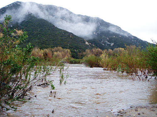
San Luis Rey River – https://www.nrdc.org/experts/damon-nagami/another-agency-steps-protect-san-luis-rey-river-proposed-garbage-dump
Land area within the San Luis Rey WMA is fairly evenly distributed between its three hydrologic areas, each encompassing slightly over 100,000 acres. Nevertheless, despite this even land distribution, all incorporated areas of the watershed are located in the Lower San Luis Rey system. As such, monitoring and inspections of the hydrologic area’s municipal separate storm and sewer systems are performed by the County of San Diego and the Cities of Vista and Oceanside.
Water that drains through the basin eventually finds its way to the Pacific Ocean by way of the San Luis Rey River Estuary. The approximately 164 acres of wetland in the estuary are known to provide critical habitat to several species of concern, including the least bell’s vireo, southwestern pond turtle, and the belding’s savannah sparrow.
The most developed sub-watershed in the San Luis Rey WMA, its land area is divided up between residential (35%), agricultural (25%), and military (7%) land uses. Approximately twenty-one percent (21%) of the area remains undeveloped or is being maintained as open space and park lands.
Relative to its counterpart hydrologic areas, the San Luis Rey system suffers from the most pressing water quality issues. Under Section 303(d) of the Clean Water Act, for example, lower San Luis Rey River was listed as impaired for chloride, enterococcus, fecal coliform, phosphorus, total dissolved solids (TDS), total nitrogen as N, and toxicity.
Monserate HA (903.2)
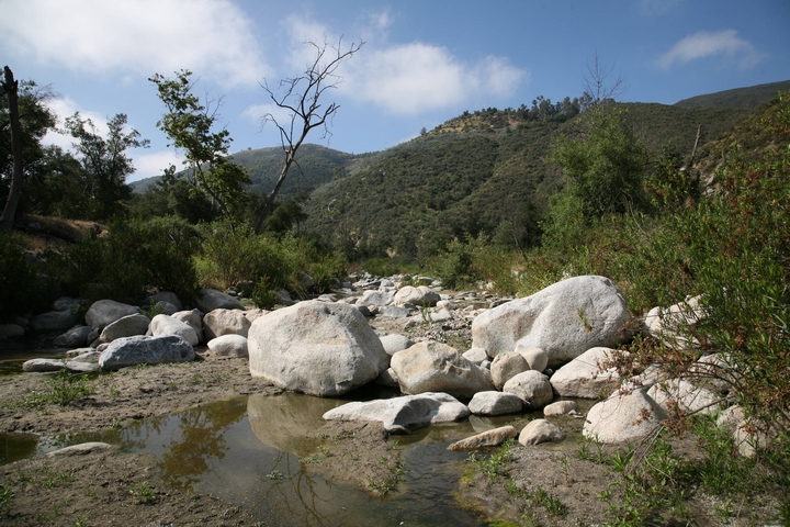
Wilderness Gardens Preserve http://www.sandiegocounty.gov/content/dam/sdc/parks/WildernessGardens/Wilderness%20gardens%203.jpg
Making up the headwaters of the watershed, the Warner Valley Hydrologic Area covers a land area of about 133,000 acres and is managed entirely by the County of San Diego.
Located near the edge of the hydrologic area lies Lake Henshaw, a reservoir established with the construction of the Henshaw Dam in 1923. The entirety of the sub-watershed drains to the reservoir, which has a storage capacity of about 52,000 acre-feet and provides water to the northern portions of San Diego County.
Remaining largely untouched, about ninety-one percent (91%) of the Warner Valley system is made up of undeveloped and open space lands. The system also encompasses lands belonging to a number of federally recognized tribes; namely the Santa Ysabel and Los Coyotes Indian Reservations.
Warner Valley HA (903.3)

Lake Henshaw – http://www.lakehenshawresort.com/images/Home_411x308.jpg
Making up the headwaters of the watershed, the Warner Valley Hydrologic Area covers a land area of about 133,000 acres and is managed entirely by the County of San Diego.
Located near the edge of the hydrologic area lies Lake Henshaw, a reservoir established with the construction of the Henshaw Dam in 1923. The entirety of the sub-watershed drains to the reservoir, which has a storage capacity of about 52,000 acre-feet and provides water to the northern portions of San Diego County.
Remaining largely untouched, about ninety-one percent (91%) of the Warner Valley system is made up of undeveloped and open space lands. The system also encompasses lands belonging to a number of federally recognized tribes; namely the Santa Ysabel and Los Coyotes Indian Reservations.